


De Marneroute
Take a look

View all 4 pictures
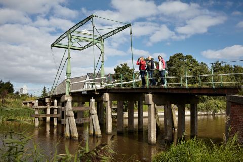
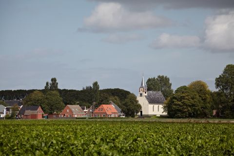
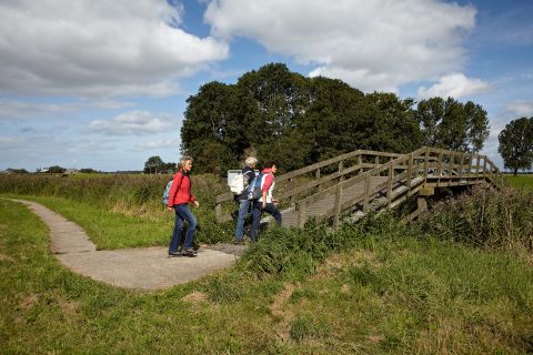
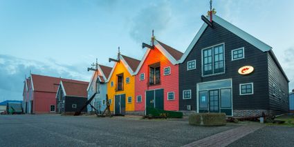
This is a lovely hiking trail which leads through a wonderful old landscape and past noteworthy sites that tell an interesting story, like the domain where the Asingaborg once stood, the extraordinary rectory of Niekerk and of course the fishing port of Zoutkamp.
Locations on this route
The Tea Factory
The Tea Factory is a unique combination of the only tea museum in the Netherlands, an atmospheric tea-house with perhaps the most extensive tea menu in the world and a fragrant tea shop.


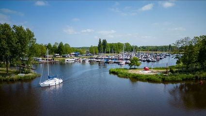
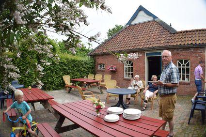
Hunzegat marina
The Hunzegat marina near Zoutkamp is the perfect operating base by the Lauwersmeer lake. Enjoy the calm in this beautiful harbour and explore the highland waterways. The fifth night is free if y...
Robersum Recreation
Our group accommodation right by the beautiful Lauwers Lake has no less than 10 bedrooms for 34 persons in total. Robersum is an accommodation that’s comfortable and has enough space for everyone!
Directions
- Junction marker 520 m
- Turn into the Cockstraat here. At the next crossroad (after 85 m), turn right (Brugweg). Follow the road to the left. Were the road crosses the water: go straight ahead onto the gravel path (through the park) and follow this path along the water. Turn left at the end (Trekweg). After 90 m, turn right onto the brick path. Turn left at the crossroad. After 45 m, turn right, pass the gate and enter the park. Follow the path to the left around a rectangular separated part of the park. Behind it, turn left and go straight ahead, leaving the paths between the beeches to your right. Go straight ahead over the wooden bridge and turn right at the end (Singel). Continue straight ahead when your reach the crossroad, in the direction of Niekerk/Zoutkamp, and cross the bridge.
- Junction marker 651.2 km
- Straight ahead (Tilweg). After 700 m, the road curves to the right; turn left at this point, Vlakkeriet. Walk straight ahead for another km.
- Junction marker 903 km
- Turn right onto the concrete cycle path(Weemsterpad) to Houwerzijl. Cross the cattle grid at the end of this path.
- Junction marker 914.1 km
- Turn right here, cross the bridge (Houwerzijlstertil) onto a broad concrete path in the direction of Niekerk. After 120 m, the path curves to the right; continue straight ahead at this point onto the cycle path, Niekerkerpad. After a small bridge, it becomes a brick path. Continue straight ahead, until you reach the urbanized area of Niekerk.
- Junction marker 875 km
- Turn left. Shortly afterward your will encounter a crossroads; turn left here, into the Kerkstraat. After 600 m, turn left in direction of Houwerzijl/Oldenhove. After 450 m turn right, Vliedorpsterweg. After 600 m the road makes a sharp curve to the left. 445 m further ahead, turn right before you reach the first farmhouse to your left. After 740 m, follow the road as it curves sharply to the left and turn right before the dyke, Windeweersterweg (concrete path). Further ahead the path leads over the dyke. After passing the cattle grid at the bottom of the dyke, continue straight ahead on the cycle path. Take the first exit left, entering the woods. Follow the path to the left and then follow the sharp curve to the right along the rim of the woods. At the next curve to the right, you turn left and cross the bridge. After 75 m, turn right onto the first path in the direction of the urbanized area of Zoutkamp. At the crossroad with the brick path turn left and directly after that turn right (De Schans). At the end of the road (red crossroad) turn left (Churchillweg). At the point where the road makes a sharp right turn: go straight ahead (30 km zone). Pass through the opening in the dyke and turn right onto the Reitdiepskade. On the square, with the statue to your right, ascend the stairs where Sluisweg and Spuistraat come together.
- Junction marker 7010.7 km
- Turn into the Spuistraat and turn right at the end. When the road curves slightly to the left, take the cycle path which runs to the right side of the road and cross the bridge between the sluice and the small dock. Continue for about 600 m, then cross the road to the left in the direction of Zoutkamperril/Vierhuizen (beach road). Turn right directly after that and pass underneath the dyke past [junc. 72].
- Junction marker 7211.8 km
- Turn right directly after this and continue along the bottom of the dyke. After you pass the farmhouse, follow the road to the right, the Panserweg.
- Junction marker 4012.4 km
- Go straight ahead, cross the provincial road and continue straight ahead. 250 m after the first sharp curve, turn left. When the road curves to the left again; turn right onto the cycle path in direction of Niekerk/Ulrum, Robersummerpad.
- Junction marker 5013.9 km
- Turn left in the direction of Ulrum, Wester Aikemapad. After 125 m, after the sharp curve to the left, turn right. After 450 m, cross the provincial road and continue onto the paved road.
- Junction marker 5115.2 km
- On the junction with the asphalt road (Spoorstraat) turn right. After about 10 m, you will reach a road fork; turn right here onto the cycle path (Elensterweg), follow this path to the left and turn left after another 100 m. After 285 m, just before you reach café-rest. Neptunus, turn right: Louten, your starting point.
‹› ALONG THE ROUTE
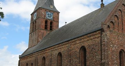
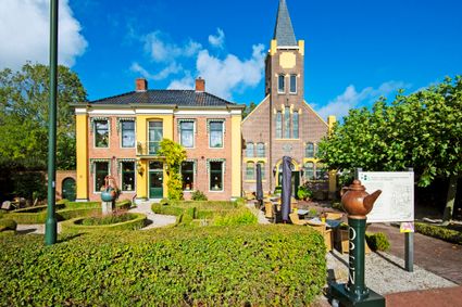
- Pastorie (Niekerk) Ontworpen, net als menig andere woning in NW-Gr., door ...read more ›
REVIEWS This route does not have any reviews yet.
- 91
- 90
- 89
- 23