The ‘high’ polders of Terschelling
-
High polders
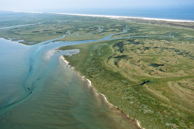
The Stryperpolder is the oldest polder on the island, one could say the mother of Terschelling's agricultural land. It is still very recognisable as a channel landscape, with the Stryper marsh on the other side of the dike. The polder was named after its oldest settlement, Stryper, constructed on a natural mound formed by the dunes.
South of this settlement the early inhabitants created their ‘Nieuwland’. In 1602 the first dike around the Stryperpolder was constructed, albeit somewhat rudimentary. Until the 19th century the dikes burst on a regular basis, the last time being in 1825. The polder was submerged and behind the demolished dike, the strong currents created deep puddles or ‘wielen’. The Ponswiel behind the old inner dike was created in this way. A reminder of the ruthless power of the sea.
Man made Terschelling's polders safe and inhabitable while nature - the dynamics of the sea - made them fertile. Unlike the typical polders on the Dutch mainland, Terschelling's polders have a higher altitude than the land on the other side of the dunes. The polder soil slopes down from the higher sand grounds to the lower parts. Ditches (sienen) drain the water from the dunes. In the lower parts they pass into marsh channels or creeks.
DISCOVER THE STORY WITH THIS ROUTE:
-
Water Heritage
Water Heritage
-
Terschelling
Terschelling