Discover the military heritage of Noord-Holland
-
Noord-Holland
Wadden at War
-
Noord-Holland
Wadden at war
The Kop van Noord-Holland owes its character largely to its strategic location on the Wadden Sea. The ‘Gibraltar of the North’ was attractive to friend and foe, and that is evident everywhere you look. Go and look for traces of the past. Visit fort Stelling of Den Helder from the Eighty Years’ War, the Netherlands war of independence. Take a look at the forts built by Napoleon or go and see the casemates on the Afsluitdijk near Den Oever. They have a story to tell.
-
In Napoleon’s footsteps
In Napoleon’s footsteps
Walk past Napoleon's heritage in and around Den Helder. The Emperor called this ‘The Gibraltar of the North’.

-
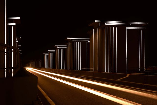
Gates of light
Gates of light
If you ever have the opportunity, go to the Afsluitdijk at night. Daan Roosegaarde put the sluice complex near Den Oever in special ‘gates of light’.
-
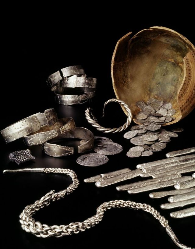
Treasure of a Viking
Treasure of a Viking
In 1996, three silver hoards were found near Westerklief. The artefacts are so special that an information centre was set up.
-
Drowned polder
Drowned polder
Just before the end of the war, the German army flooded lake Wieringermeer and all its buildings. We are still wondering why.
-
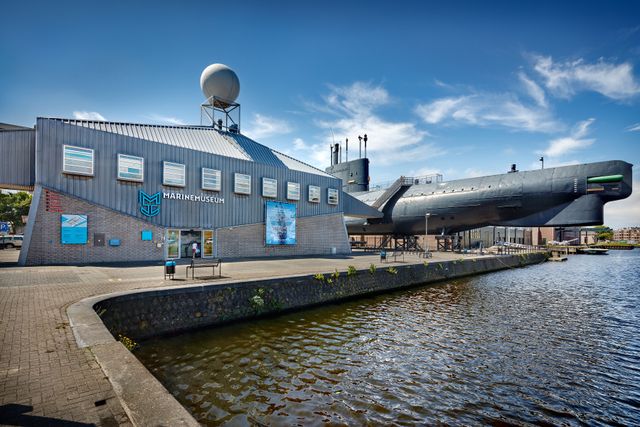
Peek in the Tonijn
Peek in the Tonijn
The Naval Museum in Den Helder is impressive in every regard. Take a peek in the Tonijn, a 78- metre long submarine.
Must-read - The most beautiful stories about the military heritage
-
A special story in a special building
A special story in a special building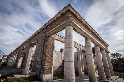
In 2009, the former Administration building of the German navy in Den Helder burned down almost completely. Yet it was not demolished. Rietvink Architecten used the ruin as the basis for the new Atlantikwall Centre.
-
The strategic importance of the Afsluitdijk
The strategic importance of the Afsluitdijk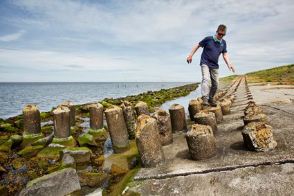
The former Minister of War was not comfortable with the construction of the Afsluitdijk. A quick connection between Friesland and Noord-Holland also meant a quick passage for enemies. That is how the Afsluitdijk acquired its casemates.
You need to experience this - Experience history with the most beautiful routes
The military strategic landscape - of the coast of Noord-Holland
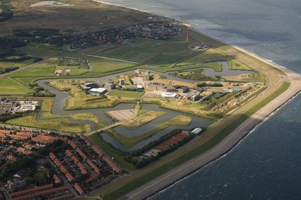
A coast line is always vulnerable to attacks from outside. Throughout history, the Dutch coast has been defended with fortifications on several occasions. Ever since the Eighty Years’ War (1568 - 1648), Stelling Den Helder had been used as a defence against naval attacks. At the end of the eighteenth century, Den Helder was an important port. The naval port was on open sea and could be left quickly in case of an emergency. The strong currents meant there was limited icing over in winter.
When Napoleon visited the Netherlands in 1811, he was impressed by the strategic location of the city and the port. However, its defences could be improved. He decided that Stelling Den Helder needed to be expanded, and Fort Kijkduin, Fort Erfprins and Fort Dirksz Admiraal were added.
Camouflage
Before the French period, fortifications were still built with materials from the surrounding area. It meant they blended into the landscape and added a little. Just like the terps, dwelling mounds and dykes, the forts came from the landscape itself. The expansion of Stelling Den Helder was a turning point. It was the first time that the Wadden landscape was subordinated to military strategic principles on a large scale.
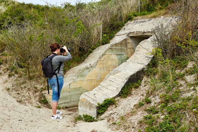
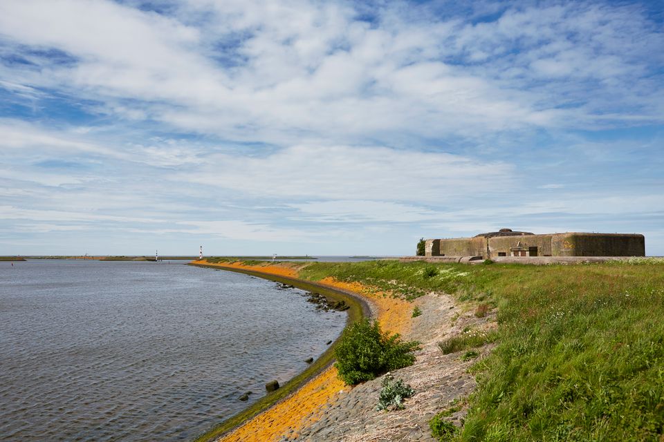
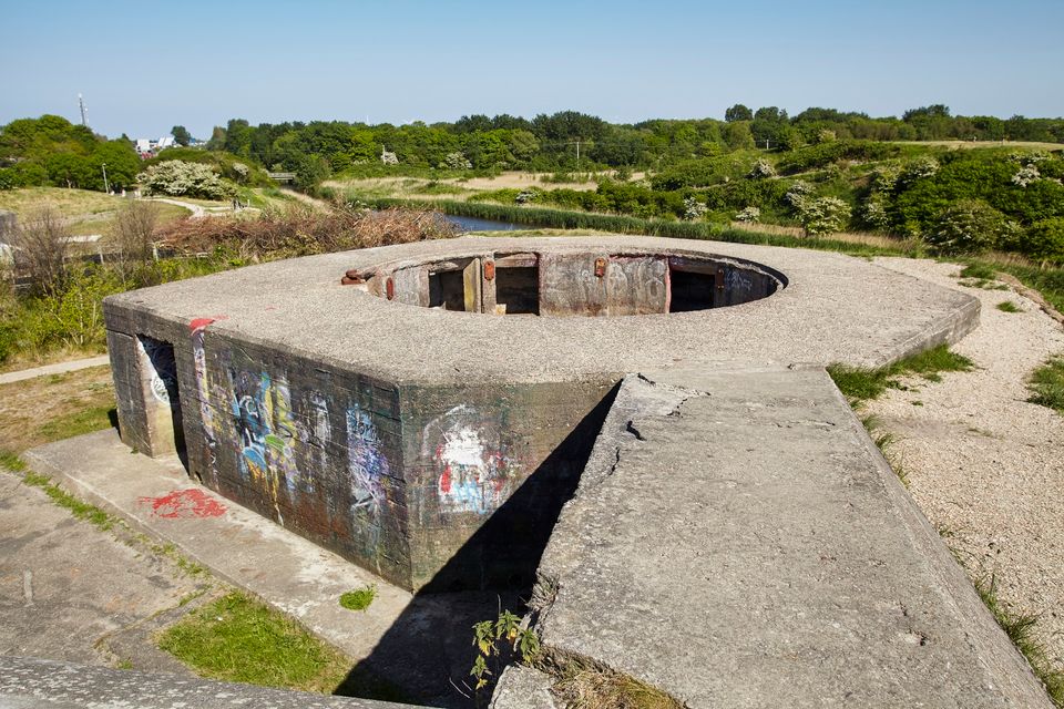
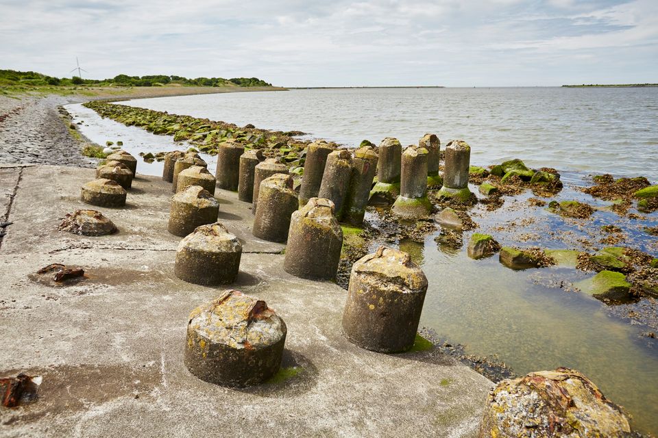
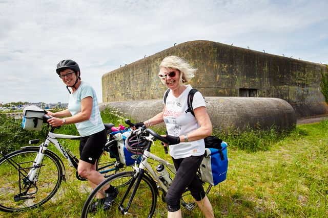
During the inter-war period, Stelling Den Helder was developed even further. On the east side of the locks near Den Oever and on both sides of the dyke, the Robbenplaat was raised. This had just one purpose - stop an enemy who had broken through and who was approaching the Kop van Noord-Holland over the Afsluitdijk. Around the discharge sluices of Den Oever heavy-duty casemates were built too. These sluices were crucial and should never end up in enemy hands; they needed to be defended at all cost.
(tekst gaat verder onder foto's)
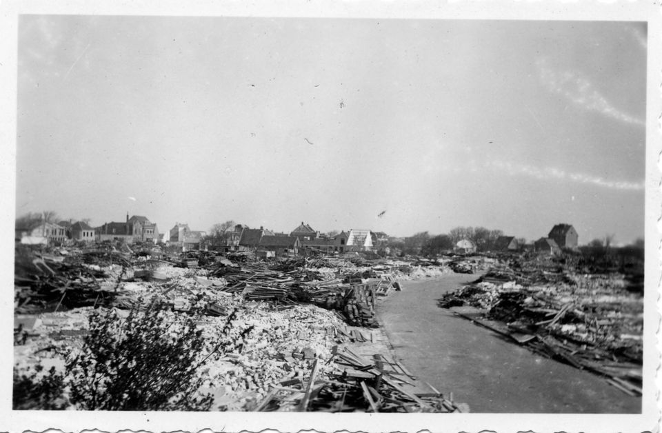
Gone with ‘Ouwe Helder’
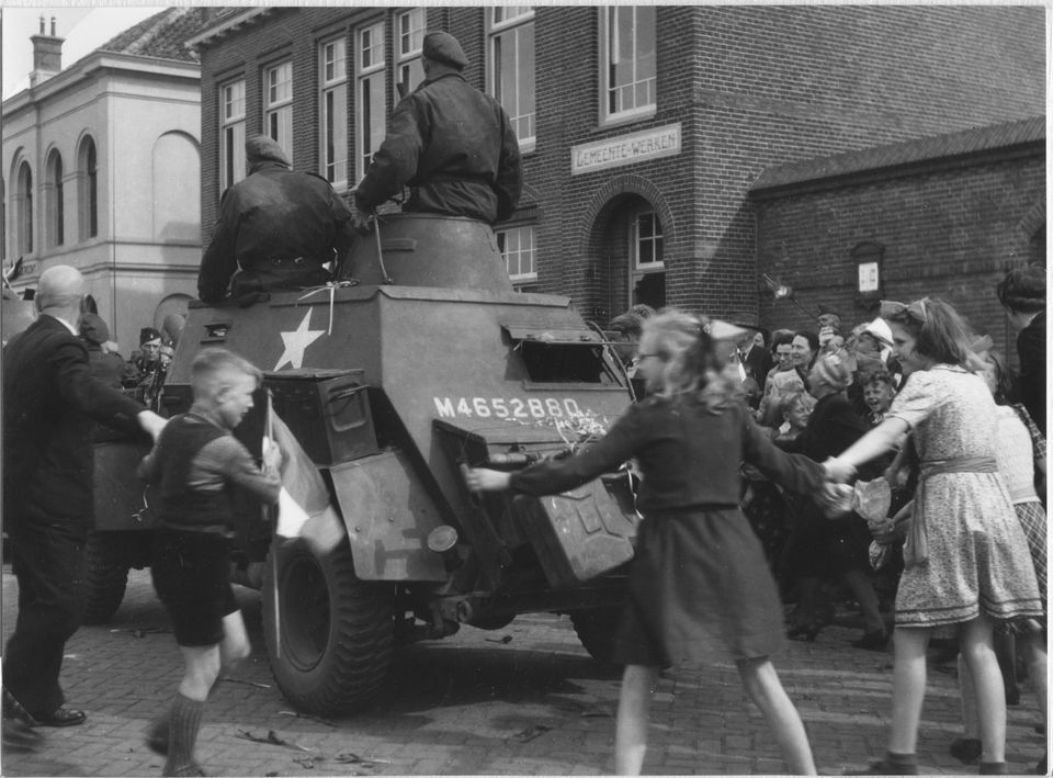
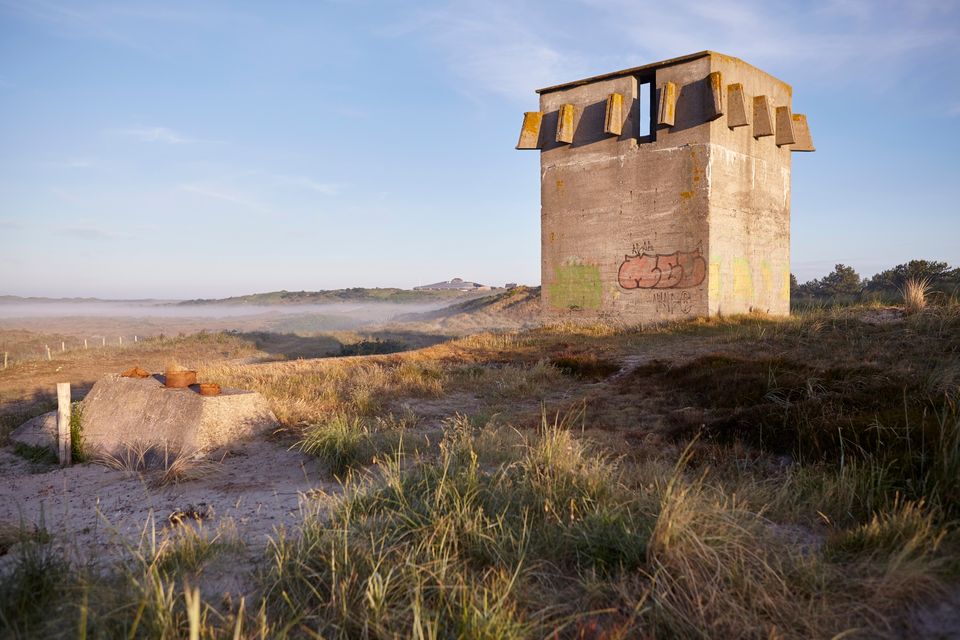
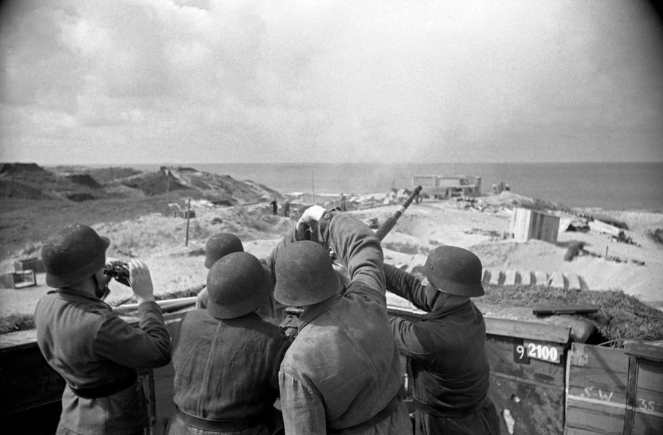
This created a new military landscape along the Afsluitdijk, and this landscape changed even further during the Second World War. According to the Germans it was not logical for the allied forces to start an invasion in Den Helder, as it was easy to trap them there. Yet the naval port and the access to Marsdiep were defended with coastal gun emplacements along the Den Helder coast and on Texel. Enemy ships could possibly penetrate deep behind German lines via Marsdiep.
Unlike the Wadden Islands, Noord-Holland is connected to the mainland. It meant the Germans needed to take this into account in their defence of the vulnerable rear of the Atlantikwall. They built defensive lines in a semi-circle around the key points along the coast, consisting of anti-tank ditches, anti-tank walls, dragon’s teeth barriers and bunkers for flanking artillery.
Following General Rommel's visit to Den Helder in 1944, the German command decided to demolish part of the coastal constructions. It is how they created a clear line of fire for the defence on the land side of the bunkers along the coast. ‘Ouwe Helder’, the oldest part of the city, and the buildings behind the dyke were razed to the ground.
Dangerous for the coast
Many of the fortifications were demolished after the war. Along the sea defences near Den Helder many bunkers had to disappear, because they were a danger to coastal protection. Yet there are still enough traces in the Wadden landscape. Anti-tank ditches and walls and dragon's teeth barriers can be found in many places. The casemates near Den Oever are also still there, although they have been hidden by nature. You can also still visit Napoleon's beautiful forts.
Beautiful or ugly, our military heritage made and shaped the entire Wadden coast to what it is today. At the same time, the landscape and nature always had - and still have - their impact too on the various fortifications. You can see that everywhere you look.
-
Atlantikwall in wadden region
Atlantikwall in wadden region
The Atlantic Wall changed the landscape of the Wadden Islands and marked the Wadden coast. You can now see and experience the story behind this fascinating World War II heritage.
-
More about the military heritage
More about the military heritage
You can discover the military heritage of the Wadden region here. Join an exciting search through accessible bunkers and museums. And experience the penetrating stories behind this fascinating heritage.